Earlier this week, I explained how color can be quantified and how the use of color might be used to examine orbital cycles in ancient rocks.
Here, I’ll describe another potential application. In this case, we’d like to be able to better define the boundary between the older Uinta Formation and the overlying Duchesne River Formation. (As an aside, Duchesne is pronounced Doo-shayne.)
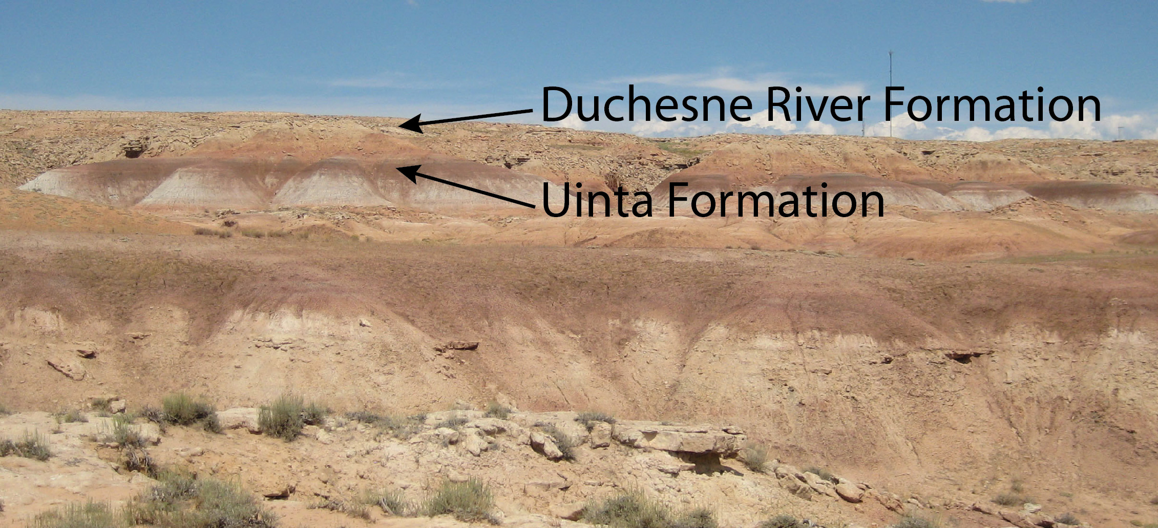
Qualitatively, the Uinta Formation has beds that are more maroon in color, whereas the Duchesne River Formation might be called more orange.
Well, we can argue about our perception of color. What is ‘maroon’ after all?
So we went out one day to look at some rocks where we knew the contact was present. High up, thick sandstones interbedded with orangish muds were clearly the Duchesne River Formation. Lower down, fossil localities in the Uinta Formation were present in deeply maroon to purple rocks. In between, though, it was hard to put one’s finger on where the actual boundary was.

First, let’s talk about the ‘boundary’ between rock formations. Or even ‘Formations’ in general.
When geologists use the term ‘Formation,’ they don’t mean cool stacks of rocks, or those pointy things hanging down from the ceilings of caves. Formation is a specific definition. A Formation is a unit of rock, distinguishable from other rocks in a geographic area based upon composition, texture, and origin (among other things). Not only is it distinct and can be described (orangish mudstones with interbedded cross-bedded riverine sandstones), but it is also of a scale that it can be seen on a map at the scale of 1:24000, or the typical 7.5 minute quadrangles you might pick up at a sporting goods store before you go on a long hike.
The boundary between two adjacent formations is called a ‘contact.’ So the question we’re asking above is really about where the contact is between the Uinta Formation and the Duchesne River Formation.
Contacts come in many types. Some are abrupt, like where a lava flow (one formation) has spilled onto a river bed (another formation). Or sometimes erosion happens, taking away a bunch of rock, then new rock is laid down on top. Or sometimes, the environment in which the rock was being deposited changes, altering the characteristics of the rock and resulting in a new formation without an abrupt change or erosion.
For example, the environment where rocks are being deposited can at first be in shallow water, then rivers with lots of sediment can come along and bury the shallow water sediments with river sediments. In these cases, it’s not always clear where one formation ends and the next one begins.
This is the case for the contact between the Uinta Formation and the Duchesne River Formation. Can color be used to distinguish between the two units?
We weren’t actually measuring rock thickness that day. We were just grabbing rock samples and taking color measurements using the RM200QC.
We visited one set of outcrops a few miles away and took some quick color measurements on some sandstones.

Then we went to the section in the previous photographs and took color measurements of both sandstones and mudstones (which are finer-grained and tend to be more brilliantly colored).

The mudstones were much more interesting.

The rocks that were definitely part of the Uinta Formation are strikingly different from those in the definite Duchesne River Formation.
As I said before, we didn’t actually measure the rock thickness. We just made color measurements and put them in order. But this is promising, and we’ll look into it in more detail next summer.
In the meantime, based upon these results, where would you pick the contact between the Uinta Formation and the overlying Duchesne River Formation?
